
Oklahoma County Neighbors Block Sources
A block search works best when each source is used for the fact it actually holds. Parcel geometry reveals what touches the subject parcel. An Assessor card identifies the public account and owner label for a selected property. The County Clerk holds the recorded instruments needed to verify a conveyance. Association layers give boundary and civic context. Historical directories may place an older household or business by address, while the voter system is a known-person registration check rather than a street-wide browser. None of these sources creates a complete list of your Oklahoma County neighbors.
| Source | What It Shows About a Block | Access |
|---|---|---|
| OKC and Edmond GIS parcel layers | Adjacent polygons, parcel IDs, streets, and boundary context | Free map or service; not a survey |
| Oklahoma County Assessor | Selected parcel’s public account, owner label, situs, and mailing field | Free public search; not a household list |
| County Clerk ROD | Recorded ownership instruments for a selected parcel | Portal or office; coverage and copy access vary |
| OKC association layer | Active association area and name | Free map, table, and download; municipal coverage |
| Oklahoma Voter Portal | Known-person registration and district information | Name and date of birth; no block browsing |
| OHS address collections | Historical occupant, business, or neighborhood leads | Research Center and collection access; years vary |
Owner and occupant are not interchangeable. A mailing field can point to where tax notices go, and a historical directory can record a dated address. Neither proves a current household, family relationship, or daily presence. Keep the map selection, parcel ID, and source date together so that a later search can be checked rather than repeated from memory.
Oklahoma County Parcel Neighbors
Start with the subject address in the City of Oklahoma City GIS or the municipal layer that covers the property. Zoom to the parcel boundary and identify the polygons that share an edge or corner. Carry each parcel ID, address, or PIN to the Assessor instead of trying to infer an owner from a map label. A parcel is a defined piece of land. Its situs is the property location. Both terms need to stay separate from a person’s current location.
The sample Oklahoma County Assessor parcel card shows the kind of fields that can appear for a selected account, including a public owner label, situs, PIN, legal description, billing address, value history, structure details, exemptions, and deed-transaction columns.
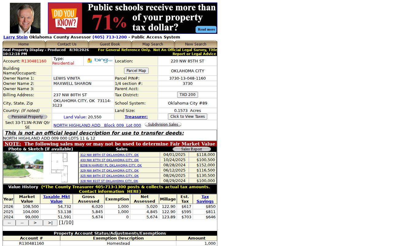
The sample illustrates why a parcel card is a property record, not a roll of the people who may be at the address.
- Find the center address in the applicable GIS layer and confirm the candidate before using it.
- Record the subject parcel ID, boundary, and the adjoining parcel IDs visible at the same zoom level.
- Open each selected parcel in the Assessor search and preserve the situs, owner label, legal description, and transaction lead.
- Use the County Clerk ROD/UCC portal to verify a recorded ownership claim with the instrument rather than the map alone.
- For a full named-street record chain, use the Oklahoma County street directory rather than extending a block search beyond its purpose.
Oklahoma County GIS Block Flow
Map geometry adds context that a parcel card cannot. The Oklahoma County Assessor’s GIS description includes address, owner, account, street-intersection, and buffer-zone searching, plus city boundaries, school districts, political districts, floodplain, contours, and imagery. The County specifically describes notice buffers such as 300 feet, though the current live viewer’s select and measure controls were not fully exposed during research. Use any small-radius selection as a saved map method, not as a claim about an informal neighborhood boundary.
At the county edge, the Edmond adjacent-parcel GIS layer offers a useful municipal example. Its metadata describes parcel geometry, address matching, updates every two to three months, and an approximate three-to-ten-foot accuracy range. That level of precision helps orient a block, but it is not a legal survey and should never replace the plat or recorded description.
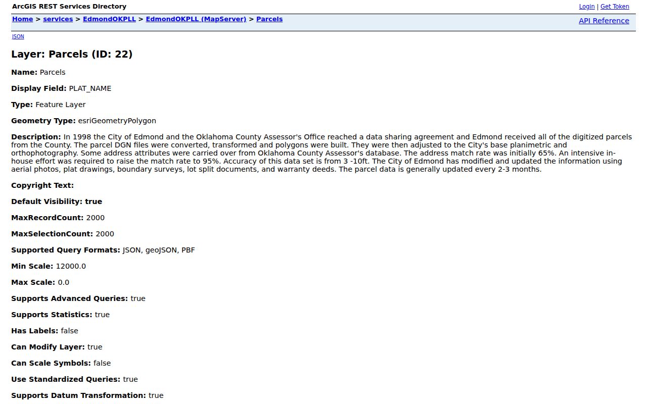
When municipal lines change the available layer, first confirm which city owns the map before comparing adjacent parcels.
The OKC public street layer also exposes valid left and right address ranges, street class, facility or street ID, and maintenance responsibility. Those fields can explain why a geocoder candidate differs from a simple street-name search. Save the candidate result and layer date before using it to connect a block address with a parcel search.
Note: Save the map source, layer date, selection method, and parcel identifiers with the result so another researcher can reproduce the block context.
Oklahoma County Association Boundaries
Association boundaries are a community layer, not proof of membership or residence. Oklahoma City’s open-data dataset identifies active neighborhood associations within the city and offers map, table, filter, and download views. Its inspected metadata showed a July 1, 2026 update. Use it to normalize a neighborhood name and compare a parcel with the current association area. A modern association outline may not match an old plat, historic district, mailing city, or the legal addition shown on the Assessor record.
The Oklahoma City neighborhood-association layer is the appropriate starting point for that comparison. It covers Oklahoma City, not every municipality in Oklahoma County.
The layer can place an address in civic context without exposing an association’s private member information.
OKC Association Layer
Use the city’s map, table, and download views to check an active association area and the dataset date.
Neighborhood Alliance
The Neighborhood Alliance registry describes association names, boundaries, leadership routes, and confidential registry handling.
Parcel and Plat Check
Compare the association area with the Assessor addition or legal description and the Clerk plat when an edge matters.
The Neighborhood Alliance registry information describes a voluntary civic registry for associations in Oklahoma City and Norman. The organization says the registry is confidential and shared with municipalities and elected officials for notice purposes.
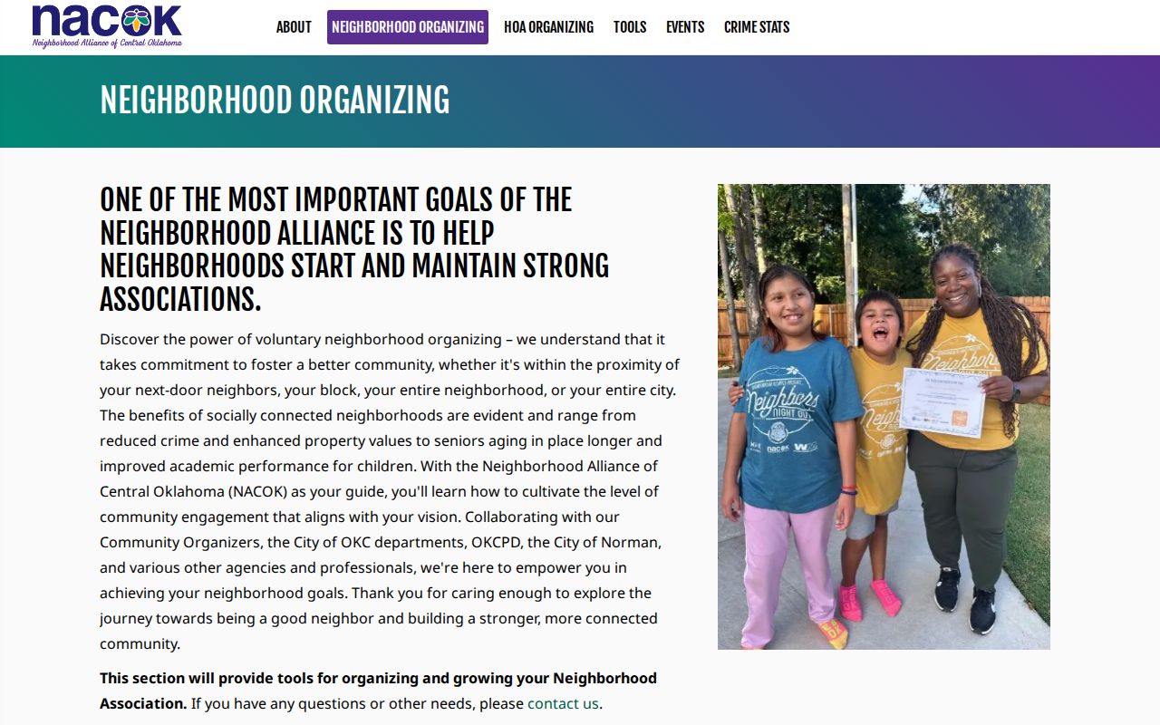
The registry can provide an association connection without creating a public list of members or their home addresses.
Oklahoma County Community Connections
Community sources are useful when the purpose is to understand a place, not to identify private households. Oklahoma City’s neighborhood resources route residents to the Neighborhood Alliance of Central Oklahoma and Oklahoma City Beautiful. The Alliance describes participation as voluntary and says its registry information is confidential, shared with municipalities and elected officials for notice purposes. It does not publish a member roster. Historical context can come from the Oklahoma Historical Society’s neighborhood publications, which include work on Crown Heights, Capitol Hill, Heritage Hills, Paseo, and other Oklahoma City areas.
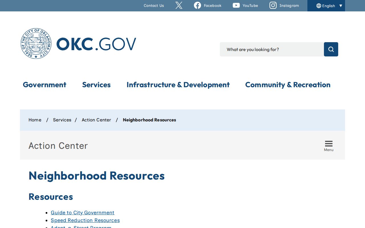
The Oklahoma City neighborhood resources page provides the official connection route rather than a directory of people. Police community-program pages can also direct associations toward watch and police-relations information, but no complete public participant roster was located.
Use a community contact route to ask about public meetings or association procedures, not to compile names or home addresses.
Oklahoma County Voter Records
The Oklahoma Voter Portal is not a block browser. It requests first name, last name, and date of birth for a known-person registration lookup, then may return registration, polling-place, district, sample-ballot, and early-voting information under the portal’s rules. A registration result is not proof that a person currently occupies an address. Do not use nearby parcel information to test people at random or attempt to build a street roster.
Oklahoma’s voter-data notice identifies public registration fields and protects application source, driver-license or state-ID information, Social Security information, and signatures. A full voter-file request has qualifying-status, attestation, and use restrictions, including limits on redistribution. For a records question, use the State Election Board’s request channel or the Oklahoma County Election Board directory rather than treating the public lookup as a downloadable list.
The Election Board says its records-request process provides reasonable access but does not create custom reports. Readily available electronic records are listed as no-fee, while paper and certified-copy charges can apply. A qualified full-file request asks for requester contact information, a qualifying status, a signature, and an attestation. That route is for authorized research under its stated restrictions, not a substitute for the portal’s known-person search or a way to publish nearby voter details.
Note: Known-person voter research should stop when the address, identity, or lawful purpose is uncertain.
Oklahoma County Neighbors Compared
Official records and commercial neighbor-lookup categories serve very different purposes. An official record has a named custodian, a stated field set, and a way to verify the underlying instrument, map layer, or request. Commercial services can merge stale or mismatched data from unknown sources and often do not identify the date or record basis for a result. For a block question, the strongest practice is to use the map for geometry, the Assessor for a public property lead, and the Clerk for any recorded title question.
| Record Route | Strength | Limit |
|---|---|---|
| Official parcel, deed, and GIS records | Custodian, dated source, and direct verification path | Shows property and geography, not a complete household |
| Neighborhood association sources | Current civic-area and contact context | Membership and registry details may be confidential |
| Commercial neighbor-lookup category | May offer a broad starting lead | Accuracy, source date, and lawful use can be unclear |
Privacy Limits for Oklahoma County Neighbors
Public access has firm limits. Utility customer lists and delivery records were not located as public sources. Driver address data is restricted. The public voter system does not support map-browsing a block, and protected voter or Address Confidentiality Program records must not be reverse-engineered. The Oklahoma Open Records Act, Title 51 §§24A.1–24A.33, supports access to nonexempt records, not the release of every personal field. When a source is wrong or creates a safety concern, contact the custodian about its correction, privacy, or redaction procedure.
The Oklahoma Address Confidentiality Program uses a substitute address for qualifying survivors, while voter privacy programs offer separate protection routes for eligible applicants. Respect those programs and the limits shown by each official source.
Lawful use. Use Oklahoma County neighbor records for personal, lawful block, property, family-history, or civic research. Do not use them to watch, harass, intimidate, or harm anyone.